|
|
|
|
|
|
|
|
|
Research Notes 2024
| June 2024 - Scorriton | |||||||||||||||||||||||||||||||||
| 1)
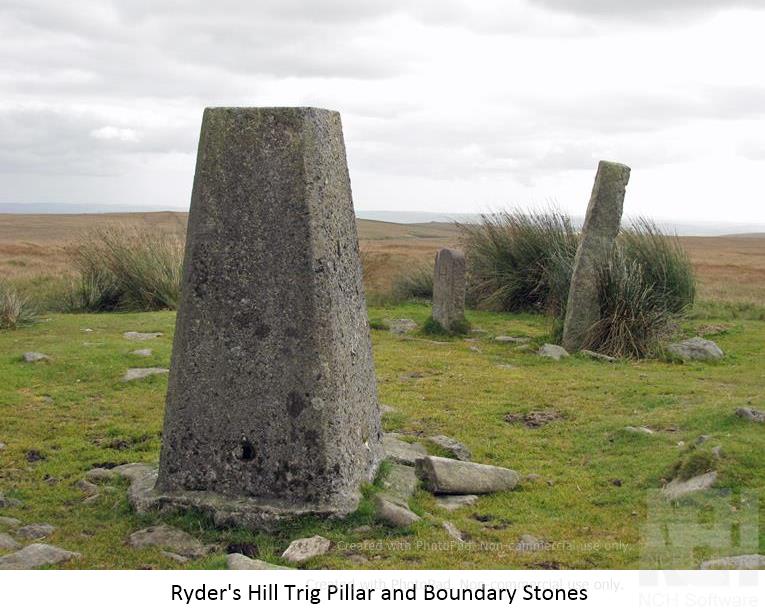
Ryders Hill - (SX6597/6906)
It would seem that sometime in the past
Holne’s original bound stone (Petre-on-the-Mount) became broken and
the Buckfastleigh bound stone erected as a new marker - apparently
taking its name - and for many years the Holne stone was not remarked
upon at all in boundary reports. The ‘H’ stone then resurfaced and
for some years lay loose beside Buckfastleigh’s tall ‘B’ pillar,
the site then becoming referred to as either Petre-on-the-Mount or
Petre’s Bound stone. Following the disappearance of the Holne stone
again (sometime prior to 1986), a replacement was erected in 1991. It was
claimed that ordnance survey’s triangulation point had been erected
over what was the original Holne boundary point. So, in order to try and
resolve the matter Eric Hemery wrote to the Ordnance Survey (OS) and
received a reply stating that the “triangulation-pillar on Ryder’s
Hill Dartmoor was built in March 1937, exactly over the old, buried
triangulation mark.” This lead Hemery to assume the OS mark was placed
under what was then called Petre-on-the-Mount and the stone moved to
make way for the offending triangulation point. In his book High Dartmoor, Eric Hemery
more or less accused Ordnance Survey of an act of vandalism (p. 303). Dave Brewer
was not convinced and several years later wrote to OS receiving a more
informative reply. They stated the original observations were taken
between the 26th July and the 22nd of August 1845. The actual spot or
mark used for the sightings was 2 feet 6 inches below the ground. After
completing the task a turf pile 12 feet in diameter and 13 feet high was
placed over the mark station. The letter also went on to say that there
was no way any Ordnance Surveyor would interfere with bound stones as it
was not only improper but against their own interests. Brewer also
managed to obtain copy of the original correspondence between Hemery and
OS and discovered that some vital wording had been omitted when he was
compiling High Dartmoor. The letter
clearly laid out the account of a 1858 survey in which it stated that;
“About 12 feet south from the station stands a stone with the letter
‘H’ rudely cut upon it, to mark the limit of the parish of Holne in
this direction.” This confirmed to Brewer that in 1858 the original
bound stone was standing away from the OS station and that the later
‘B’ stone was erected on the exact same spot. (Sources:
Dave Brewer, Mike Brown, William Crossing, Roland Ebdon, Eric Hemery and
Legendary Dartmoor).
|
|||||||||||||||||||||||||||||||||
| May 2024 - Princetown | |||||||||||||||||||||||||||||||||
| 1)
Siward's (Nun's) Cross - (SX6047/6994)
Information about Siward's / Nun's Cross can be found on our Dartmoor Crosses website. 2) Old Farm Hut - (SX6016/6991) Details of Old Farm Hut, tucked away under beech trees close to the Devonport Leat tunnel exit, was covered in the Research Notes for our walk in March 2015.
|
|||||||||||||||||||||||||||||||||
| April 2024 - Berrydown Stroll, Gidleigh | |||||||||||||||||||||||||||||||||
| 1)
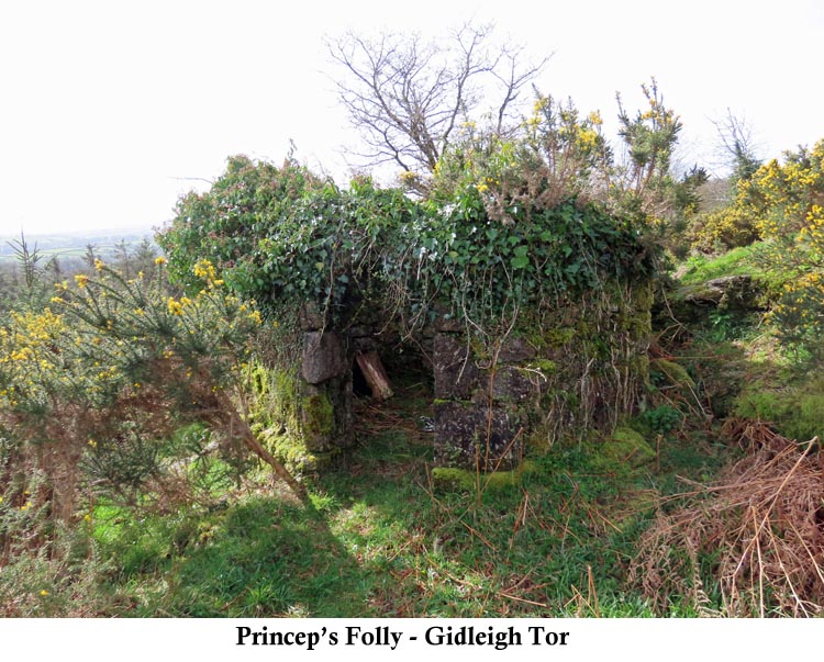
Princep's Folly - (SX6709/8778)
The house and possibly two towers were built for Thomas Levett-Princep, back in 1848. It would appear as though the Rev. A. Whipham, then Rector of Gidleigh Church, gave a 99 year lease of two acres of land at Gidleigh Tor to his friend, Mr Levett-Princep, in 1846 for the house to be built. Although the house was completed and occupied at first by a caretaker, the Levett-Princep family never actually got to live in the house. Unfortunately, Thomas Levett-Princep died suddenly in December 1849, whilst crossing Teignmouth Harbour on his boat, before he could move himself and his family from their current abode. Following his death, his widow, Caroline, arranged for the house to be demolished and the fixtures and fittings, along with the balance of the lease, was sold at auction in 1851. Thomas Levett-Princep was born in Staffordshire in 1811 and was a cattle breeder as well as being a local Justice of the Peace. Following the death of his first wife, Margaret Monro, he moved to Devon and, in 1838, married Caroline Mary Templer, daughter of the Rev. J. J. Templer, a relation of the Templer family at Stover Park who built and owned the Haytor Quarries, the Haytor Tramway and the Stover Canal. (Source: various websites). 2) Teigncombe Stone Circle - (SX6674/8652)
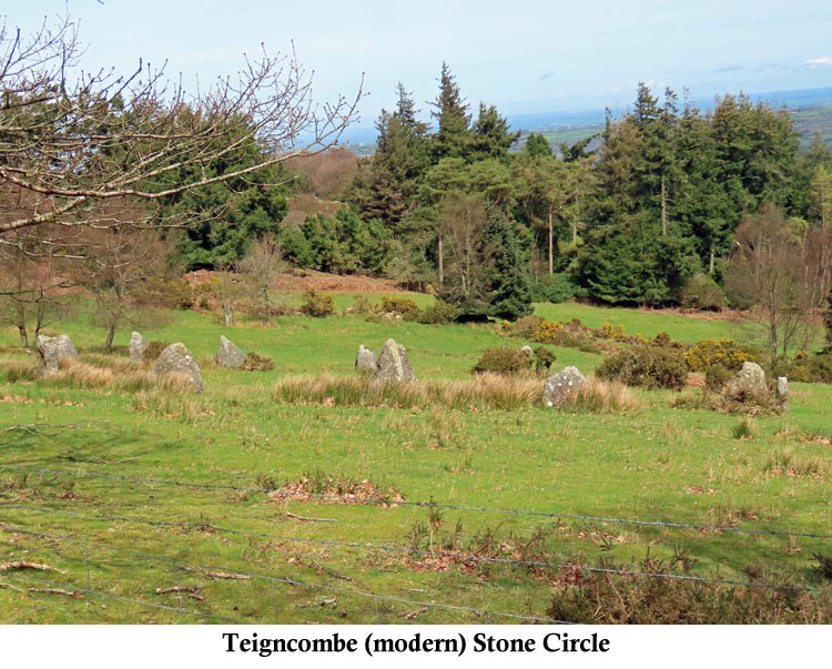
In addition to this modern circle, Teigncombe Farm does have a genuine antiquity on its land, in the form of a socket stone for an ancient stone cross. When I first saw this stone it was being used as a roadside gatepost for access into one of the farm fields. When I last visited it, in August 2021, it was no longer being used as a gatepost and had been abandoned in the field, against the roadside hedge and almost completely covered by the spreading vegetation. More information on this socket stone can be found on the Dartmoor Crosses website. (Source: Maurice).
|
|||||||||||||||||||||||||||||||||
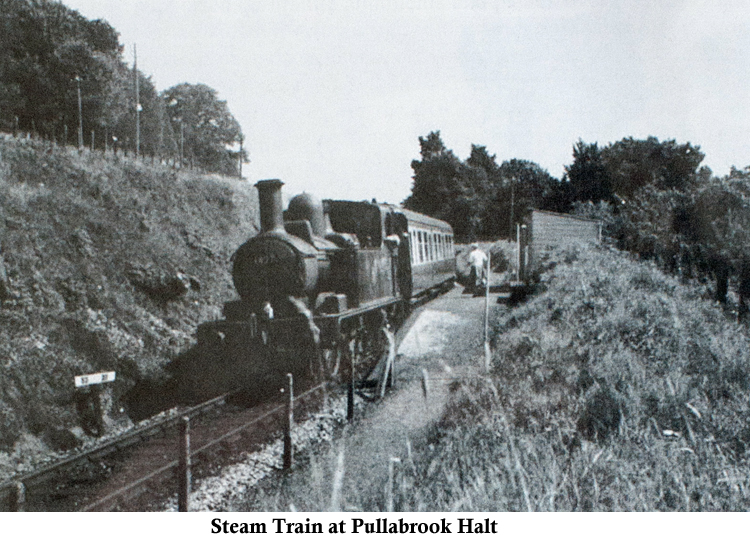
| March 2024 - Bovey Tracey (Station Road Car Park) | |||||||||||||||||||||||||||||||||
| 1)
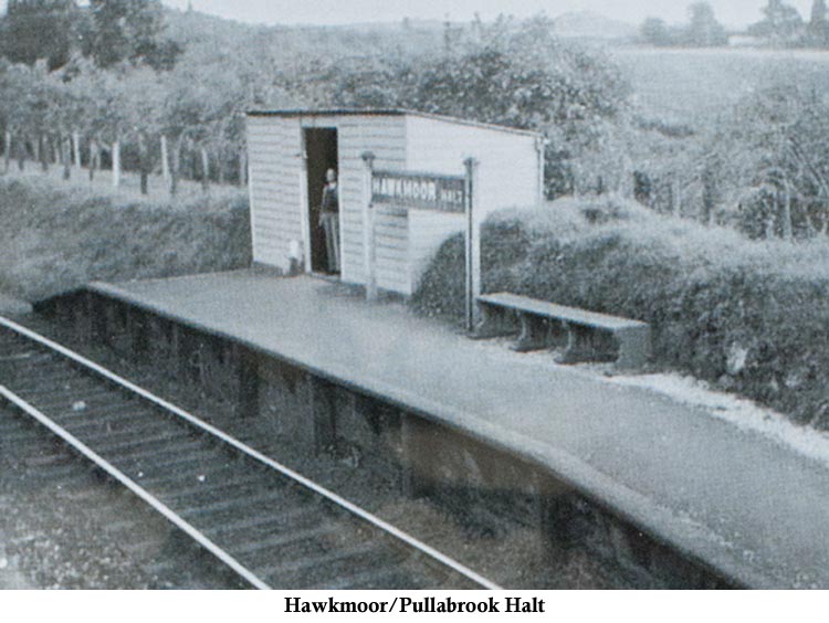
Hawkmoor or Pullabrook Halt - (SX7921/8005)
|
|||||||||||||||||||||||||||||||||
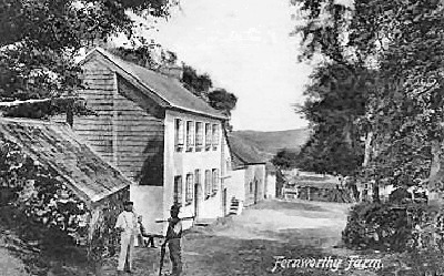
| February 2024 - Fernworthy Forest (old boat shed) | |||||||||||||||||||||||||||||||||
| 1)
Fernworthy Farm - (SX6607/8394)
The farm site is classed as ancient having a documented history going back to about 1248. With the inclusion of the word ‘worthy’ it is considered to have Saxon origins. The word 'Worth' or 'Worthy', in Saxon terms, means a homestead or an enclosed place, normally occupied by just one family. It was quite probable that it started out as just a one family smallholding and grew bigger over the years as more land was acquired.
Ancestors of
the Ferguson-Davie family of Crediton had purchased the hamlet and built
Fernworthy Newtake (enclosing 278 acres) by 1802: the perimeter wall
later adopted as the Forestry Commission’s plantation boundary.
In 1843 Richard Born was tenant to Sir Humphrey Davie. A branch of the
local Endacott family, headed by George, became Born’s successor
sometime between 1881 and 1891 and in September 1904 the Endacott’s
moved to the border-country with a family called Mortimore succeeding
them. The Davie’s eventually sold their interest in Fernworthy
Farm to the Duchy in 1917. A later Endacott (Ernest) also had
connections with the farm. Following a 1934 Act of Parliament, Torquay Corporation were empowered to construction a dam across the South Teign, thereby creating Fernworthy Reservoir. It was about this time that the farm buildings were abandoned and demolished, the dam being completed on 22nd June 1942. Sadly, there are scant records concerning the farm’s layout, although a few photos exist. References: W Crossing (The Teign from Moor to Sea) and E Hemery (High Dartmoor).
|
|||||||||||||||||||||||||||||||||
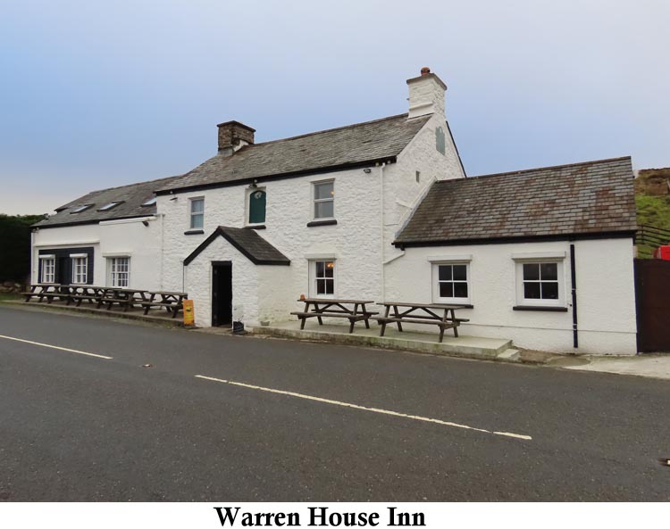
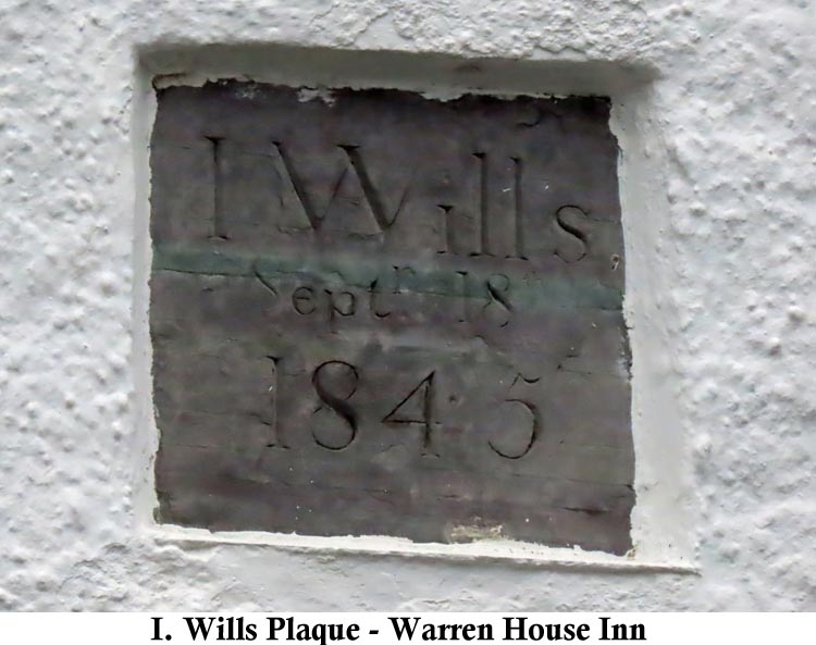
| January 2024 - Warren House Inn | |||||||||||||||||||||||||||||||||
| 1)
Warren House Inn - (SX6743/8094)
The Warren House Inn is also quite famous for keeping a continuous fire going in the hearth all the year around, although I'm unable to discover when the fire was originally lit and how long this legend has been going. In the old days, the beer was drawn from the barrel into a large enamel jug, from where it would be poured into a quart mug. The mug would be shared between four men, each taking their turn to take a drink and each would take their turn in buying the next round. During really cold weather, the men would use a 'Witches Hat' with a long iron handle to warm the beer in the peat fire. The pub must, at one time, have had quite a reputation. Once, when Jonas Coaker was the landlord, the pub was invaded by a group of miners who took over the pub and helped themselves to his beer. Poor Jonas fled the pub in fear of his life and hid out on the moor until he felt it was safe to return. On another occasion two customers got into a heated argument at the pub, which ended in a fight between them and one poor soul died as a result. The survivor was sentenced to three weeks in prison after Jonas Coaker gave evidence on his behalf quoting that he was subjected to 'Gross Provocation'. In another episode Mrs Bray, wife of the Reverend Bray, reported that a person had died at the pub whilst it was cut off during a period of severe snowfall. The body had to be salted down in a trunk in order to preserve it until the snow had cleared and the body could be retrieved for burial. It is quoted, by the Reverend Bray, that there was once one of Jonas Coaker's poems written out on a sign at the pub. This poem read:
However another author, by the name of Page, insists this is incorrect and should read:
You can take your pick as to which you want to believe. (Sources: Eric Hemery's 'High Dartmoor', pages 507-510 & William Crossing's 'Guide to Dartmoor', page 475)
|
|||||||||||||||||||||||||||||||||